


World Metro Map
Product Description
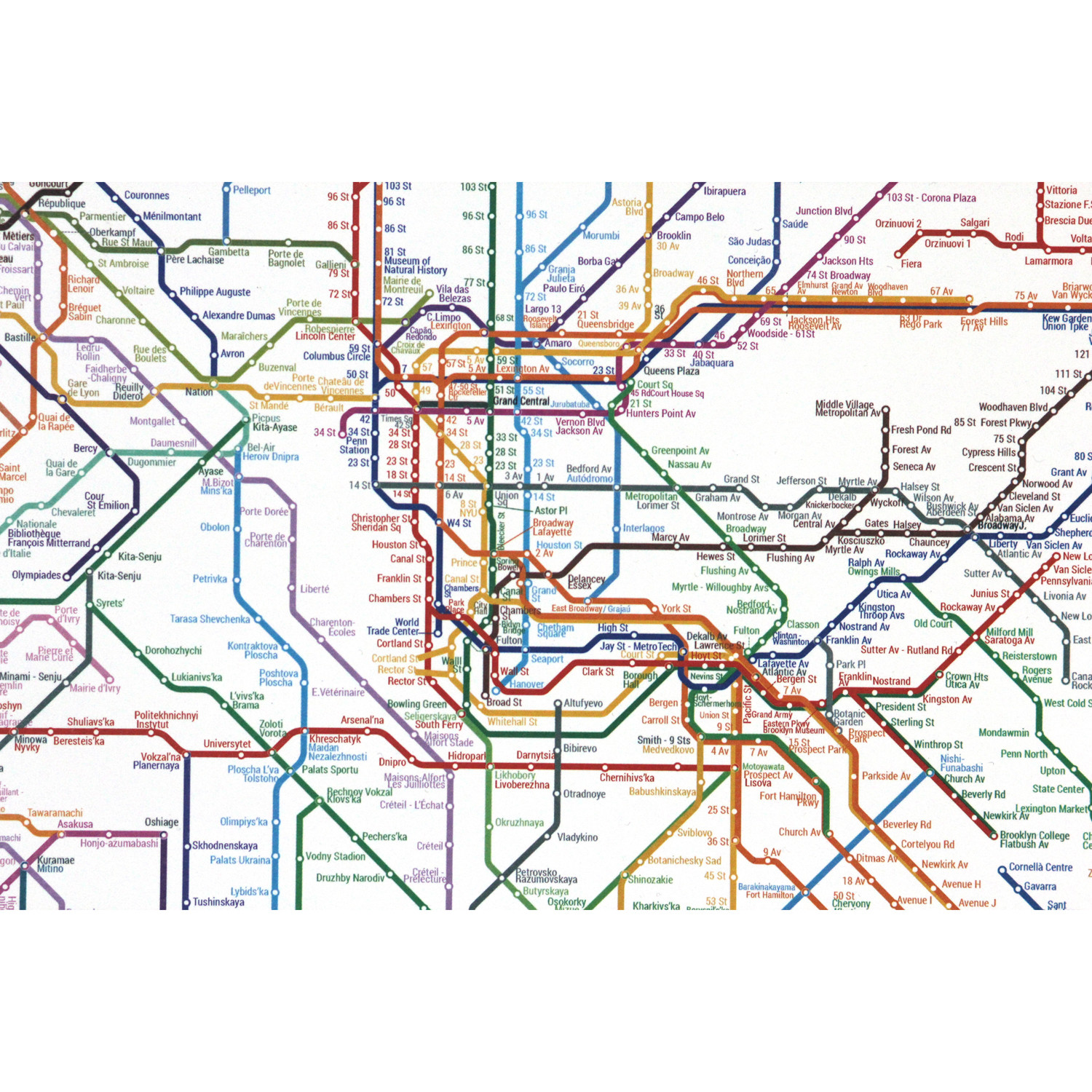
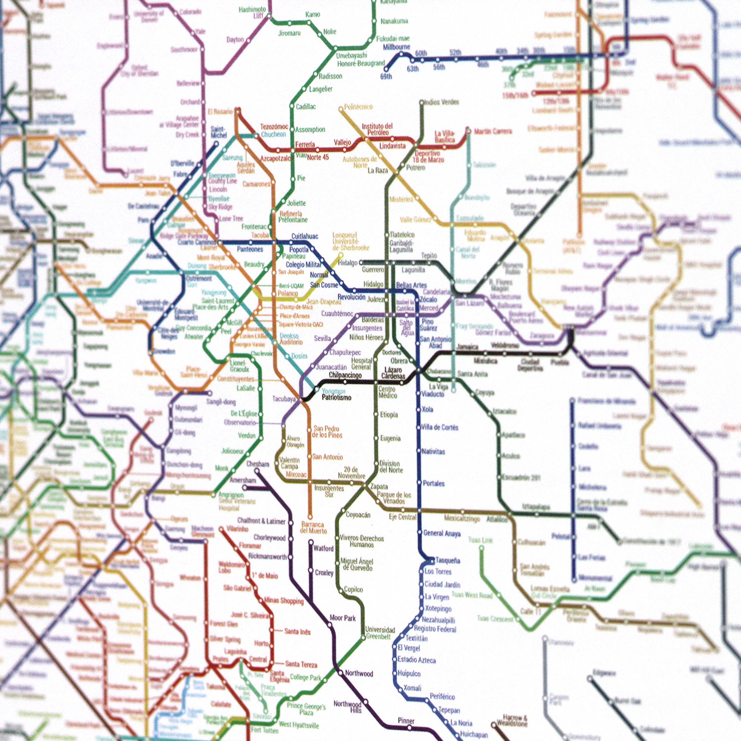
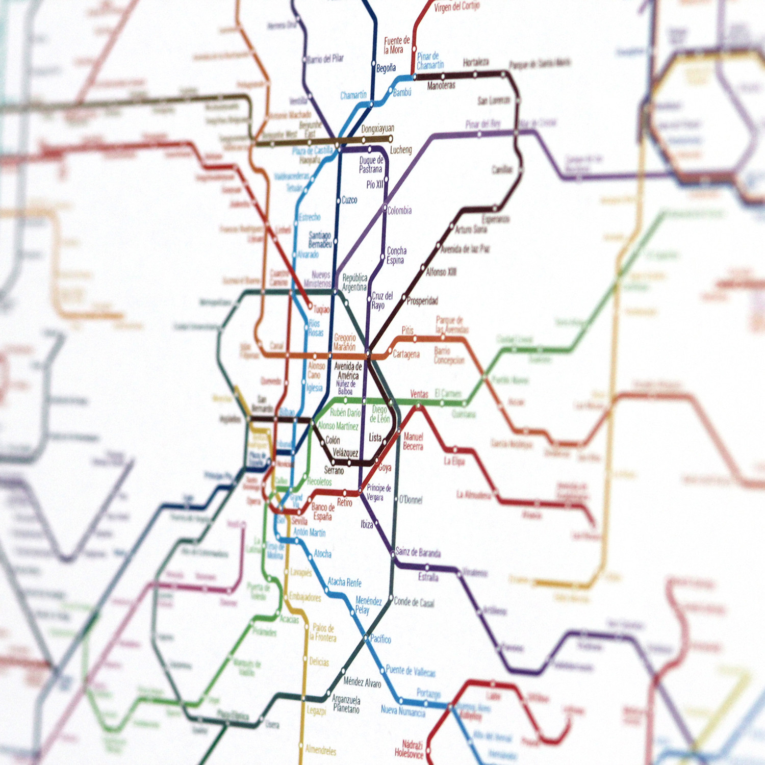
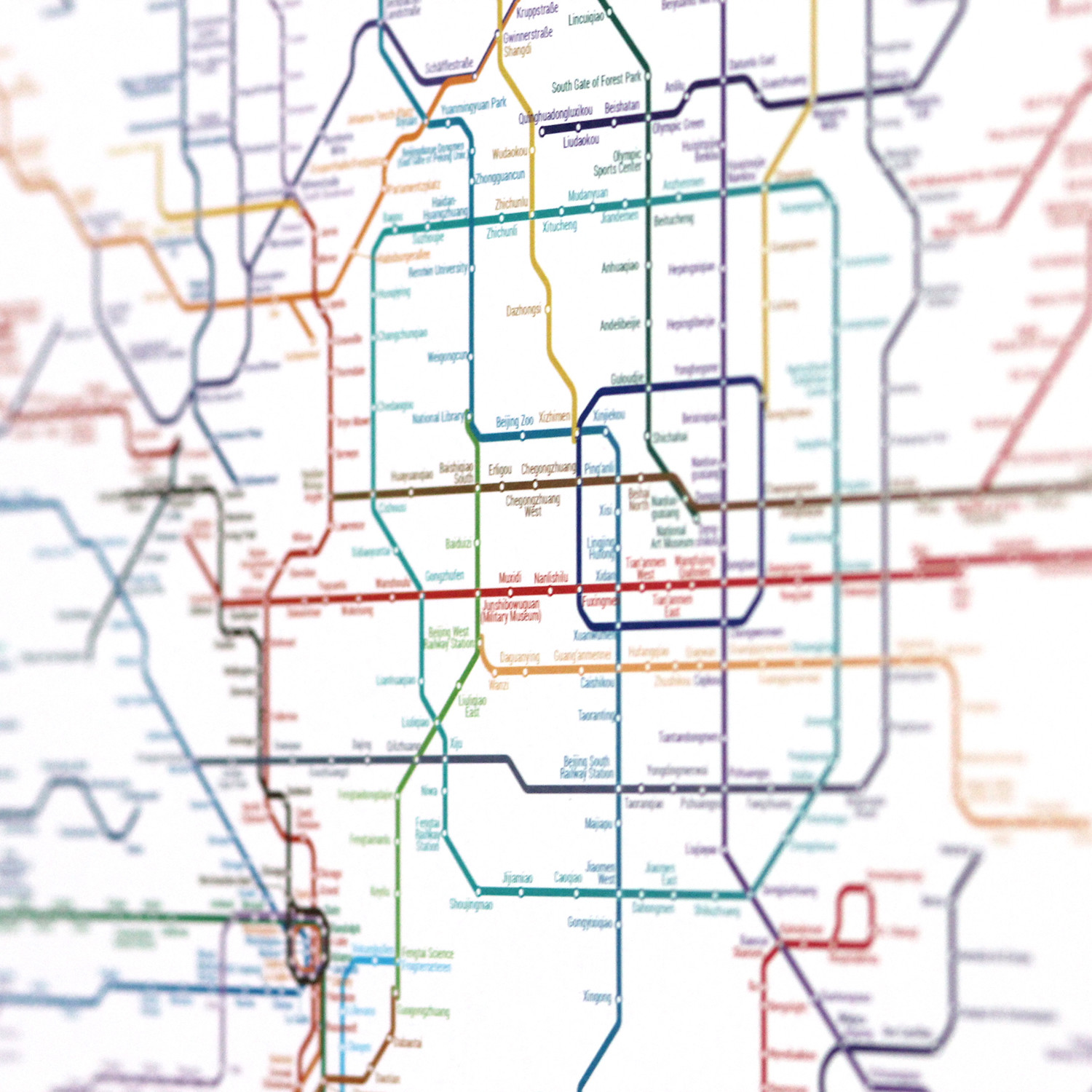
The World Metro Map is an unusual piece of art that features 214 cities and 5 continents unified in one single map. The idea was inspired by a 1959 map created by the Architect Constant Nieuwenhuys. He called his idea 'New Babylon.' an imaginary borderless system the size of the entire planet were people can travel without restrictions. New York based Collective Art+Code+Data revised this idea to create a map that represents human mobility. The inner life of cities is made of their subways. What would happened if all the lines in the world would be reunited in a single system. Since the tube is the veins and circulatory system of the 'animal-city' if we gather all those possibilities, we could achieve a total circulatory entity?
The result is a digital collage that contains 214 metro/subway systems. Totaling 791 lines and 11,924 stations . Every line in this map represents lines and stations in the real world, however all the lines are interconnected in a way that they all form a mega subway system. You can create routes from Times Square Station New York all the way to Beijing National Library Station in China.
Product Details
- ColorsMulti
- Materials
Paper
— Small: 40 x 30"
— Medium: 60 x 45"
— Printed on Paper
— Frame Not Included
— Some Proceeds Benefit Charity
Shipping Information
-
Shipping AvailabilityUnited States
-
Shipping PolicyStandard Ground Shipping
-
Ship In2-3 weeks ⓘ
-
Return PolicyFinal sale, not eligible for return or cancellation


Enter your email for immediate access

OR
Size Chart
